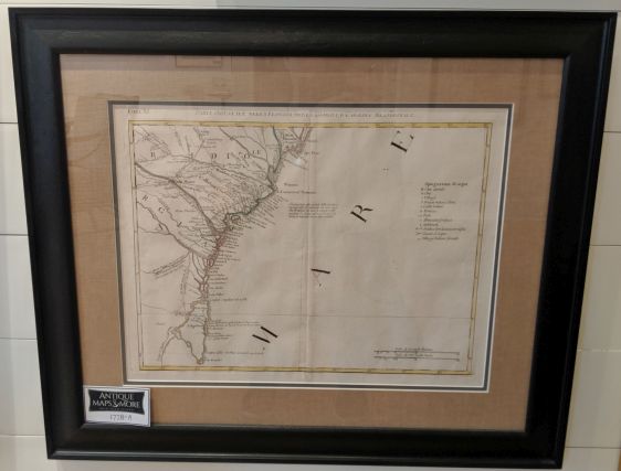
This depicts Wilmington, NC, to Cape Canaveral, FL, during the Revolutionary War. There is a note referring to the British attack on Charleston in 1776 near the center of the chart.
Dimensions: 26.5″w x 22″h
Country of Origin: Italy
Cartographer: Antonio Zatta
For more information please email maps@antiquemapsandmore.com or call 910.470.0000. Open Mon-Sun, 9AM until 4PM
6D Merchant's Row, Bald Head Island


