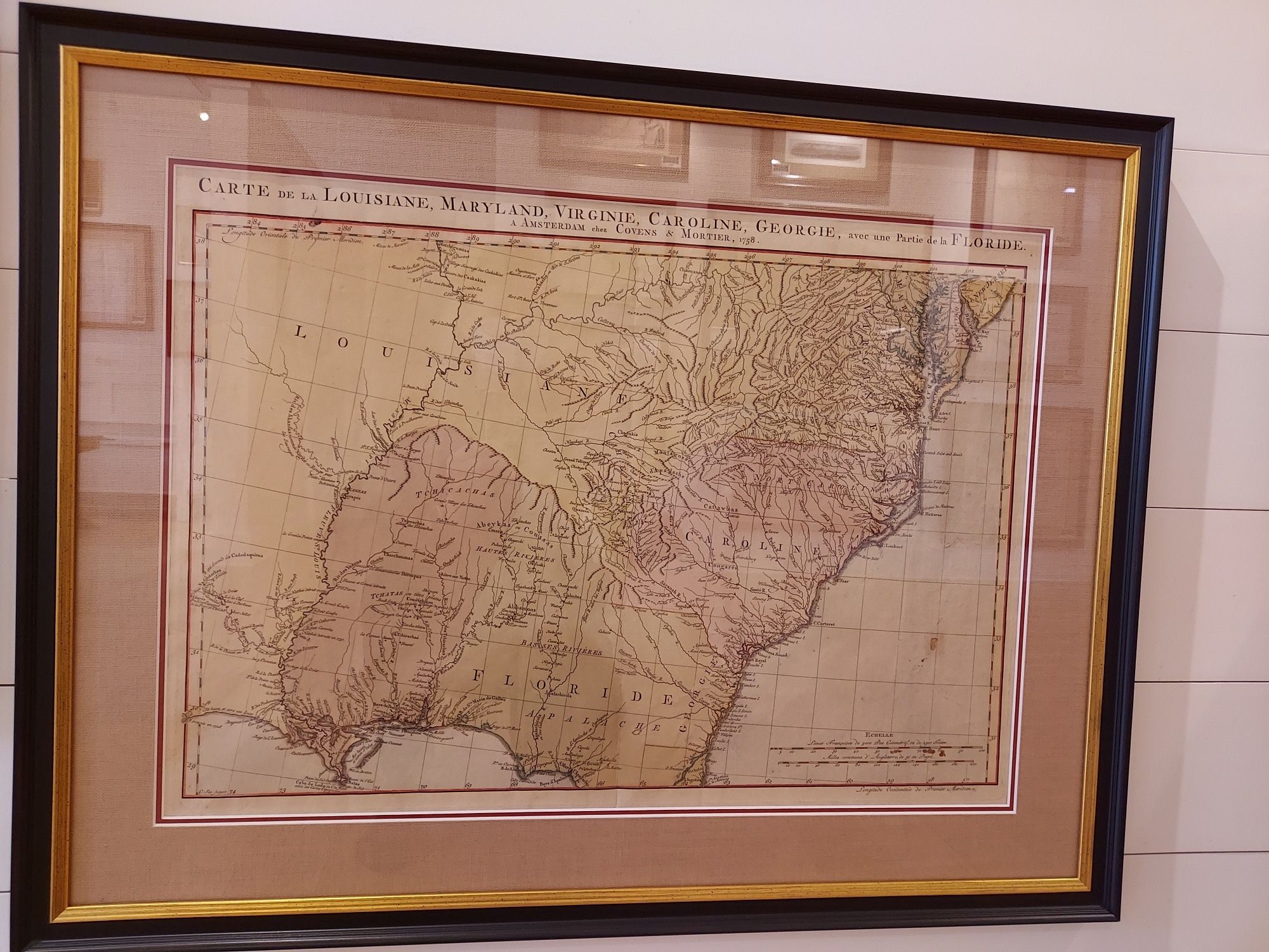
This map depicts the Southeast and Mississippi River and details French, British and Spanish claims (including those in dispute between Britain and Spain in Georgia and Florida).
Cartographers: Johannes Covens and Cornelis Mortier
Country of Origin: France
Dimensions: 38″w x 24″h
For more information please email maps@antiquemapsandmore.com or call 910.470.0000. Open Mon-Sun, 9AM until 4PM
6D Merchant's Row, Bald Head Island


