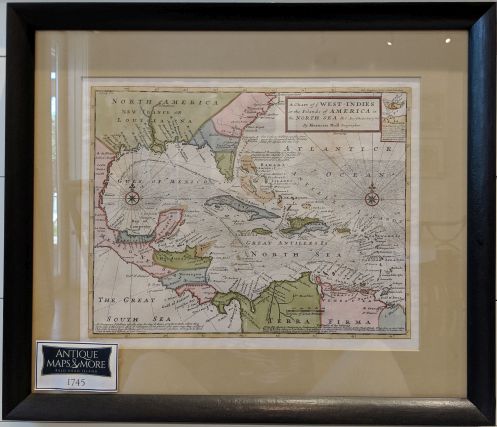
Drawn at the tail end of the Golden Age of Caribbean Piracy, this map illustrates the War of Jenkin’s Ear and the Spanish Galleon Trade. This war between Spain and Great Britain was fought by powerful trading houses. It is said Moll’s sources included pirates William Dampier and Woodes Rogers.
Dimensions: 21″w x 18″h
Country of Origin: Great Britain
Cartographer: Herman Moll
For more information please email maps@antiquemapsandmore.com or call 910.470.0000. Open Mon-Sun, 9AM until 4PM
6D Merchant's Row, Bald Head Island


