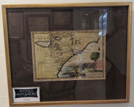
This first state first edition is based on a Mercator-Hondius model but includes updates and more contemporary information. It references French 16th century discoveries and explorations under Ribaut and Laudonniere.
Dimensions: 16″w x 13″h
Country of Origin: Netherlands
Cartographer: Peter van der Aa
For more information please email maps@antiquemapsandmore.com or call 910.470.0000. Open Mon-Sun, 9AM until 4PM
6D Merchant's Row, Bald Head Island


