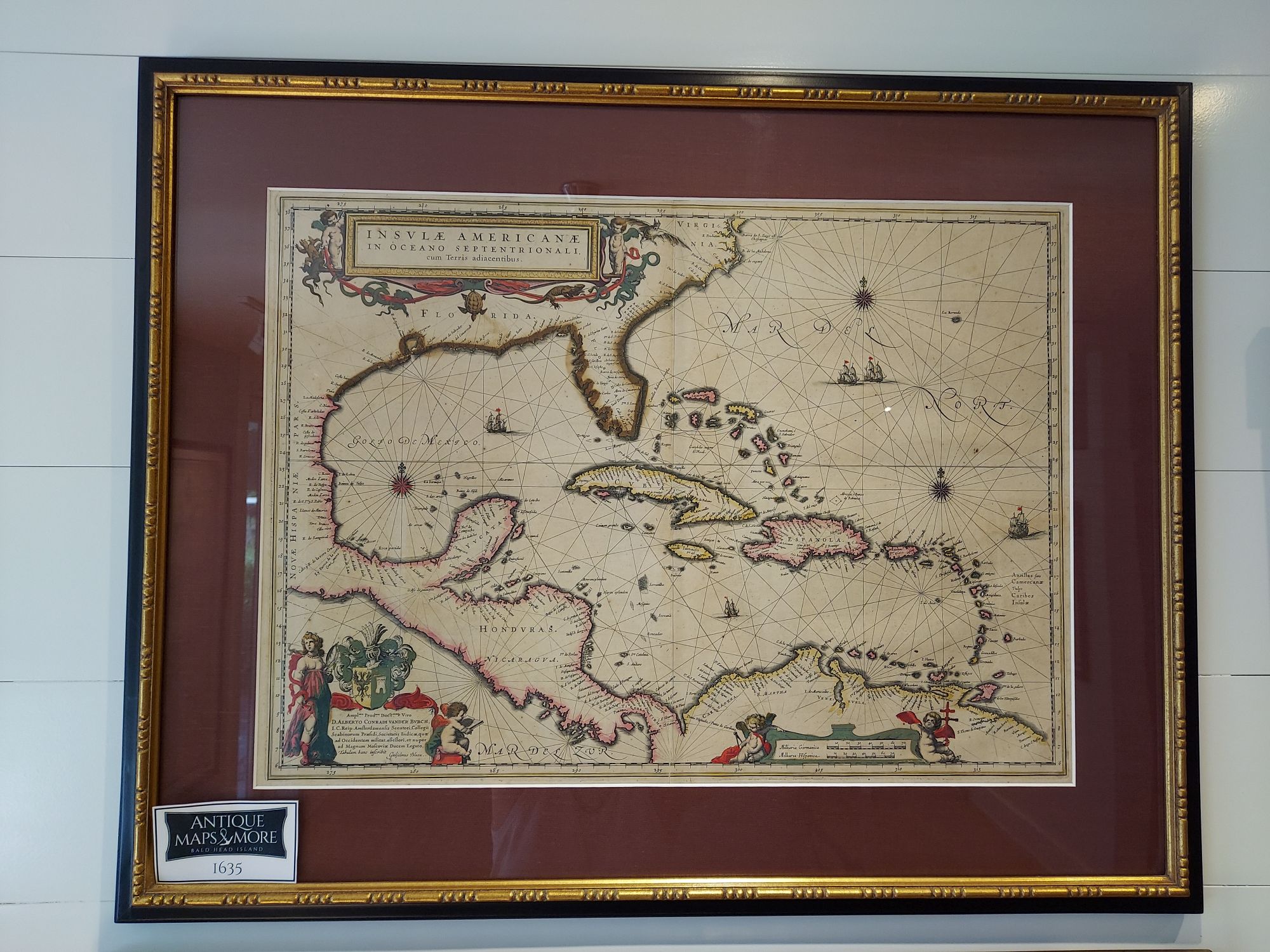
This map, by the prolific Dutch chart maker William Blaeu, features the West Indies but extends from the Carolinas to the northern coast of South America and displays 17th century geographical knowledge of the New World. It is based on the 1631 work of Hessel Gerritz who charted the region during a voyage with the Dutch East India Company. It includes a dedication cartouche to Alberto Conradi Vander Burch.
Cartographer: William Blaeu
Country of Origin: The Netherlands
Dimensions: 27.5″w x 22″h
For more information please email maps@antiquemapsandmore.com or call 910.470.0000. Open Mon-Sun, 9AM until 4PM
6D Merchant's Row, Bald Head Island


