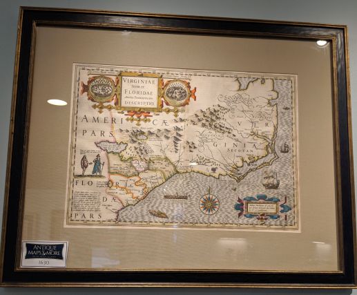
This is a map of southeastern coast from Virginia to St. Augustine, Florida featuring the Appalachian Mountains and Chesapeake Bay. The plate for this map was originally made by Mercator (1512-1594) and later added to by Hondius. It features scattered animated vignettes including sea monsters and a wild turkey.
Dimensions: 28.5w x 23h
Country of Origin: Netherlands
Cartographer: Jodocus Hondius
For more information please email maps@antiquemapsandmore.com or call 910.470.0000. Open Mon-Sun, 9AM until 4PM
6D Merchant's Row, Bald Head Island


