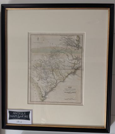
This scarce Revolutionary War era map was not published until 1832, but is based upon original papers and records from George Washington, provided by his family to Marshall. It indicates the changing positions of the American and British armies in the southern theatre of the American Revolutionary War.
Dimensions: 14.5″w x 17″h
Country of Origin: U.S.
Cartographer: John Marshall
For more information please email maps@antiquemapsandmore.com or call 910.470.0000. Open Mon-Sun, 9AM until 4PM
6D Merchant's Row, Bald Head Island


