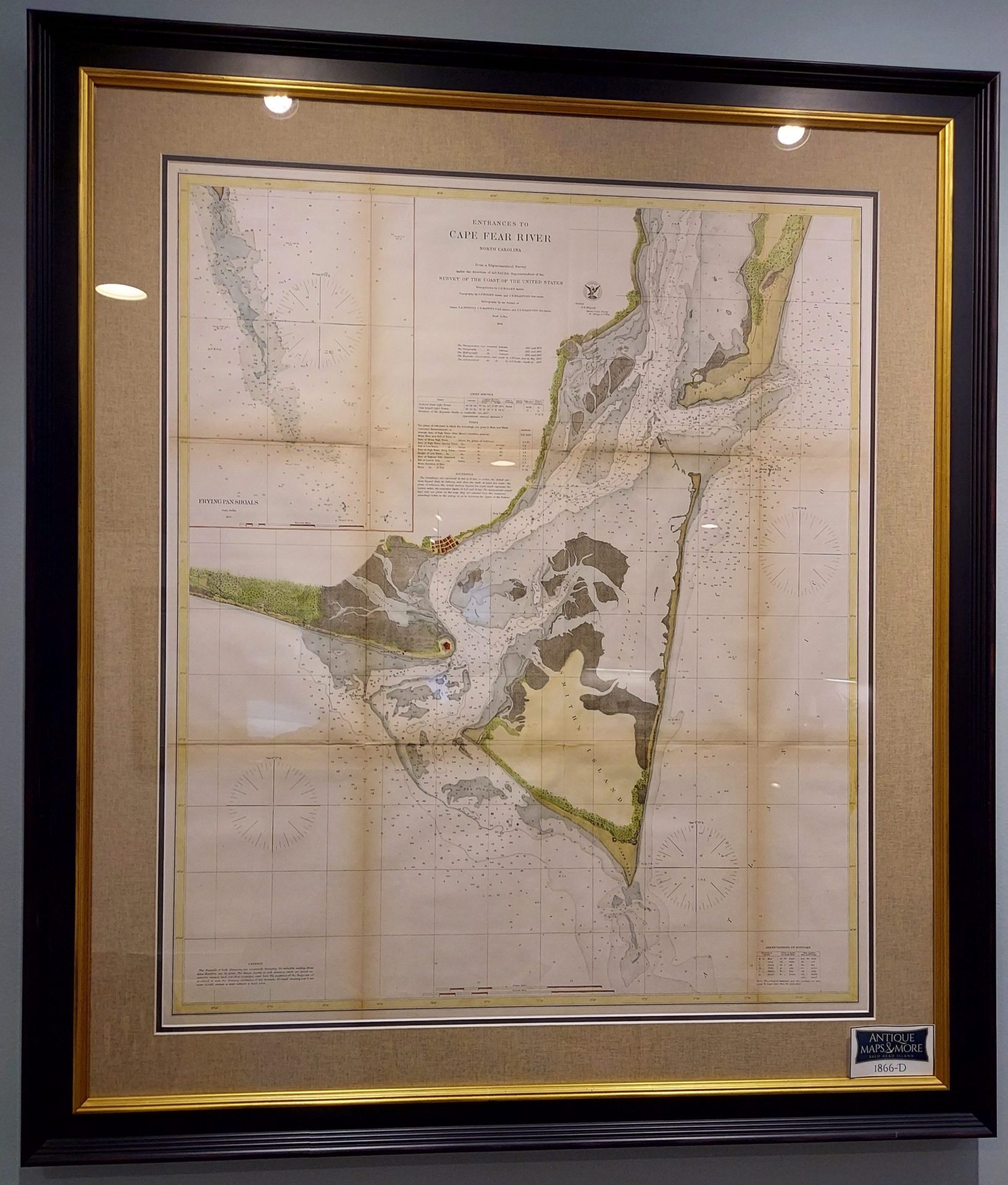
This U.S. Coast Survey depicts Federal Point south to the top of Cape Fear and then west past Smithville and Fort Caswell to Oak Island. From a nautical perspective, this chart offers a wealth of depth soundings and sailing instructions as well as information on shoals and tides. The triangulation for this maritime map was calculated by C.P Boles. The topography was completed by Bolles and J.S. Bradford. Hydrography was accomplished by Bradford, T.A. Jenkins, and J.N. Maffitt. This was published under the supervision of A.D. Bache, known in cartographic circles as the Superintendent of the U.S. Coast Survey.
Dimensions: 41″ h x 36″w
Country of Origin: United States
For more information please email maps@antiquemapsandmore.com or call 910.470.0000. Open Mon-Sun, 9AM until 4PM
6D Merchant's Row, Bald Head Island


