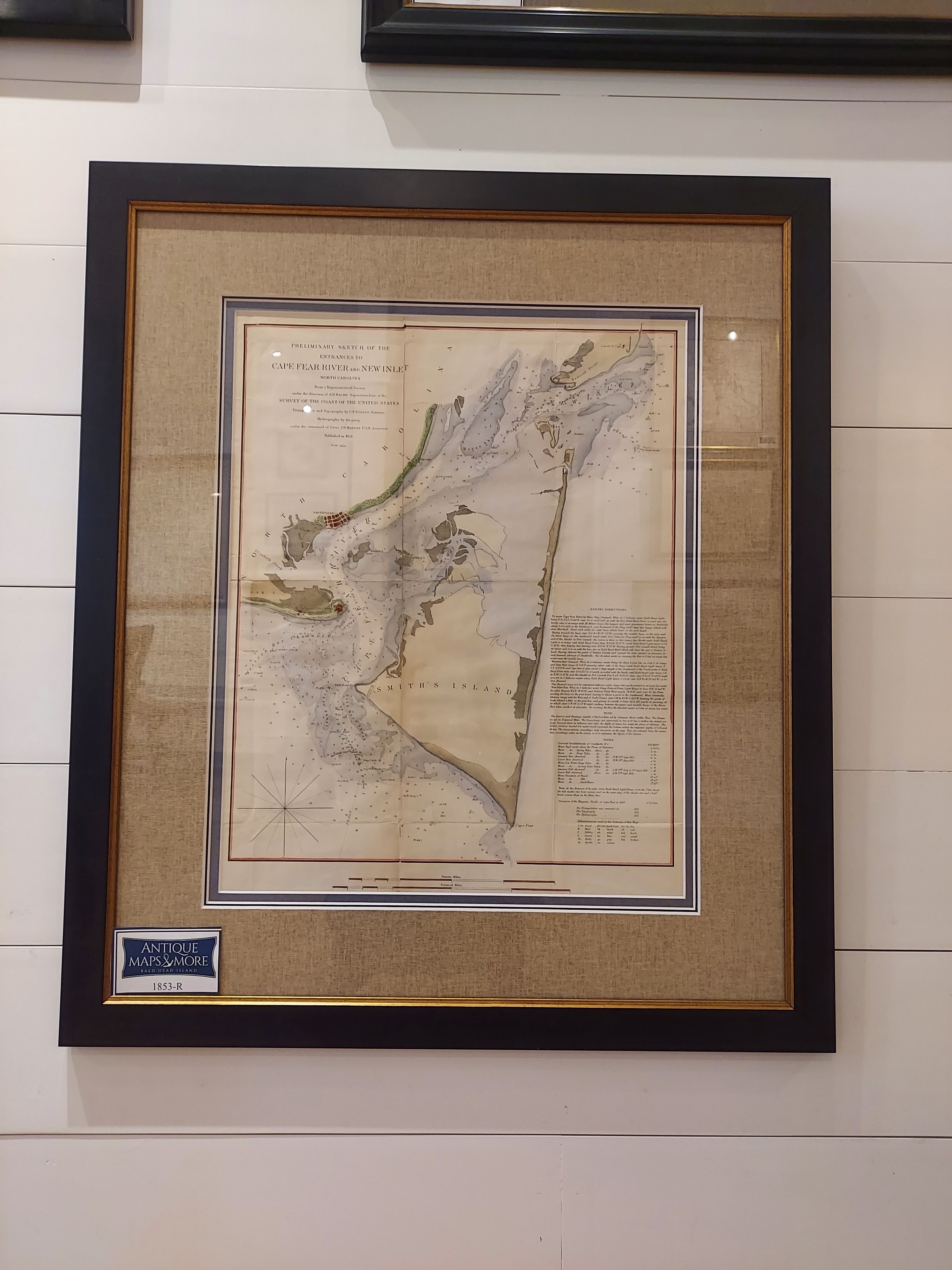
This 1853 U.S. Coast Survey nautical chart (or maritime map) depicts from Federal Point south to the top of Cape Fear and then past Smithville and Fort Caswell to Oak Island (roughly 78.04 Longitude). With some detail of the mainland as well as Smith’s Island, this attractive piece also offers a wealth of depths information and sailing instructions.
The Office of the Coast Survey was founded in 1807 by President Thomas Jefferson and is the oldest scientific organization in the U.S. Federal Government. It was established in response to a need for accurate navigational charts of the nation’s coasts and harbors. A.D. Bache, the Superintendent over this map, was the great-grandson of Benjamin Franklin.
Dimensions: 27″H x 23″W
Cartographer: A.D. Bache
Country of Origin: United States
For more information please email maps@antiquemapsandmore.com or call 910.470.0000. Open Mon-Sun, 9AM until 4PM
6D Merchant's Row, Bald Head Island


